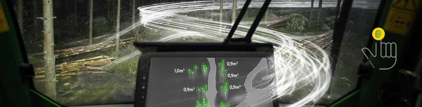
TimberMatic Maps gives operators a real-time production view to the logging site. The data collected by the harvester’s sensors and the precise GPS-based location of the felled timber, is automatically transmitted from the harvester to the TimberMatic Maps application for use by the forwarder operator.
Visualize your logging sites
The data between the machines are updated through a cloud service, and all the operators working at the same work site can see all the tree species and assortments with the driving routes right down to the individual logs.
Site planning

Site planning tool
The site planning included in the TimberMatic Maps program assists in taking into use the logging plans created in TimberManager. If there is no ready-made plan, it can also be created directly in TimberMatic Maps program and the site planning gives detailed guidance. When the area has been drawn in TimberMatic Maps, it is possible to check the timber assortments and total volumes for the whole work site.
With the good planning of the landing area locations and the more exact timing of the produced timber assortments, the whole production and logistics process can be streamlined. Machine uptime is improved and the harvester operator's own work planning is easier. When the track network is well planned in advance, the driving distance and fuel consumption decrease and the nature sites get more visibility.
The guided planning phases of the tool support the machine operator with work planning. This way the work is faster and the harvesting quality is better.
Phases of Site planning
1. Cut block boundary
- You can draw a cut block boundary by adding points on the map and use scissors to cut a hole. You can draw one or more areas.
2. Conservation areas
- You can mark areas to be protected from logging as points, lines or areas on the map.
3. Landing areas
- You can mark areas for storing logs by selecting points, lines or areas on the map.
4. Main route
- You can draw the suggested main routes between the cut block and landing area, and across the cut block by adding points on the map.
5. Places
- You can mark places to pay attention to for safety, difficult terrain etc. as points, lines or areas on the map.
6. Track network
- You can sketch a suggestion for tracks inside the cut block with a freehand drawing tool.
Highlighting the assortments
![]() The different timber assortments can be highlighted with different colors by marking them as favourites. This helps the operator to separate the assortments in the load space and to build the load so that it is already sorted. This speeds up the unloading considerably.
The different timber assortments can be highlighted with different colors by marking them as favourites. This helps the operator to separate the assortments in the load space and to build the load so that it is already sorted. This speeds up the unloading considerably.
With the help of sorters that are available for the load space, unloading mixed loads is easy and productivity is vastly improved.
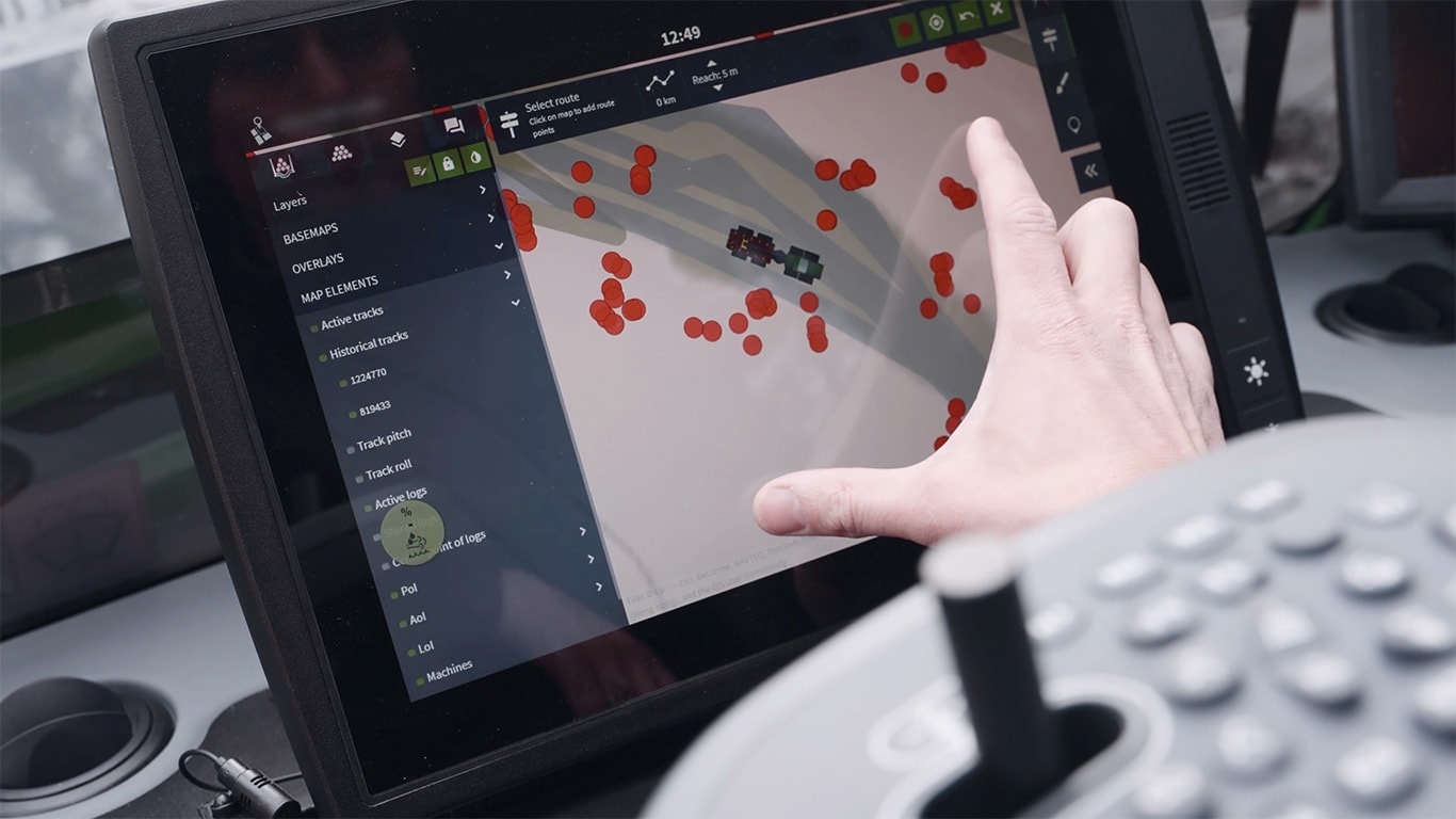
Route selection
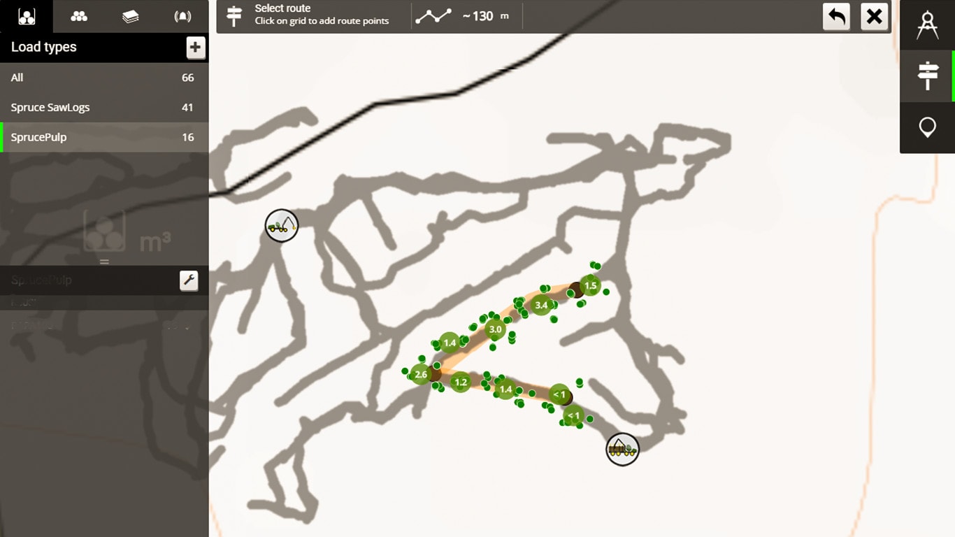
![]() You can choose a 10 m wide route with the route selection tool. It is now also possible to make a narrower route selection.
You can choose a 10 m wide route with the route selection tool. It is now also possible to make a narrower route selection.
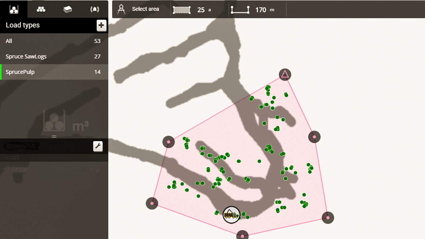
Selection tool
 With the selection tool you can select areas of different sizes. The distance from the hand-icon can be expanded or narrowed and you can edit the area with the eraser tool. You can even record the driving route and fix it with the eraser if you accidentally included extra logs.
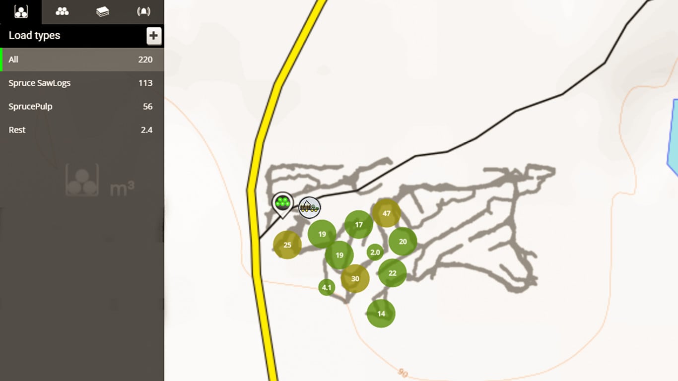
Collect and upload directly
 You can collect and directly upload the logs in the system, and easily see the amounts of different timber assortments. Even the inventory history is memorized.
Avoiding ecologically sensitive or dangerous areas
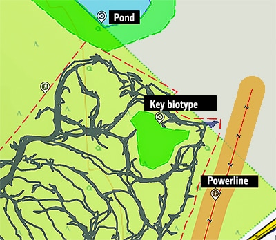 If the logging site has some noteworthy areas, like a pond, a steep slope, a spring, a brook or perhaps a power line, the harvester operators can mark it on the map with a comment. If needed, they can add an alert to the comment; this way, the forwarder operator is notified when approaching the area.
TimberMatic Maps is a new way of visualizing a logging site. The application clarifies and improves the teamwork of the machines. The operators and contractor have a real-time view to the progress of the work site.
The operator marks the forwarded timber as transported to the storage area. The operator of the next shift knows where to start their work. There is no need for an estimate of the volume and not a single log will be left even in a dark forest, for different assortments are shown on the map right down to the single log even if they are covered by snow.
Forwarder operator can choose the desired assortment from a specific area or along a logging route and the map will show the exact volume of that assortment in the chosen area. The operators can also mark special areas on the map. This way e. g. soft ground can be avoided when planning the driving route.
The map shows all the assortments down to the single log with the logging route network. Planning the work and the best driving route will be very simple.